Iowa Bicycle Map

Interactive Iowa Bicycle Map
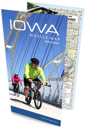
Iowa Bicycle Map (PDF)
The Iowa Bicycle Map displays hundreds of miles of multiuse trails, a summary of Iowa bicycling laws, information about multiuse trails that are 10 miles or longer, bicycling safety tips, and other general information.
The map also includes trail maps of the state’s largest cities and traffic levels for all paved roadways so bicyclists can choose the routes that best suit their level of riding experience.
INTERACTIVE IOWA BIKE Map
Quickly find paved and unpaved biked paths, as well as trailheads, restrooms, public water supplies, and more using this mobile-friendly, interactive map. Enter your location and destination, and receive route suggestions. Share your stories and experiences about bicycling on Iowa's trails and roads via the comment section.